UK 30 Day Forecast

Day 6 to 15

UK Outlook for Saturday 20 Apr 2024 to Monday 29 Apr 2024: Over the weekend and into the new week a build of high pressure will likely occur, meaning more in the way of dry and calm weather across the UK as a whole. Cloud cover is rather uncertain, as some cloudy and clear regions are expected, with the chance of frost and fog where the clearer conditions are to be found overnight. A few light showers or some light rain will still be possible at times, this will be more likely to affect peripheral regions of the country. Temperatures will overall be close to average, probably quite a muted daily cycle in cloudier areas. However, in clearer areas, some chilly nights are likely, but conversely it will feel fairly mild in any sunshine during the daytime.

Day 16 to 30

UK Outlook for Tuesday 30 Apr 2024 to Tuesday 14 May 2024: Around the turn of the month high pressure will probably remain close to the UK, with a good deal of dry and calm weather continuing for many areas. Into early May, these settled conditions will probably move northwards, with the driest weather perhaps across the northwest of the UK. If any more unsettled conditions develop these are more likely to affect south with a risk of some heavy rain or showers. Temperatures will probably be close to average overall, with warm days but some cooler nights.

Forecast courtesy of Met Office Datapoint

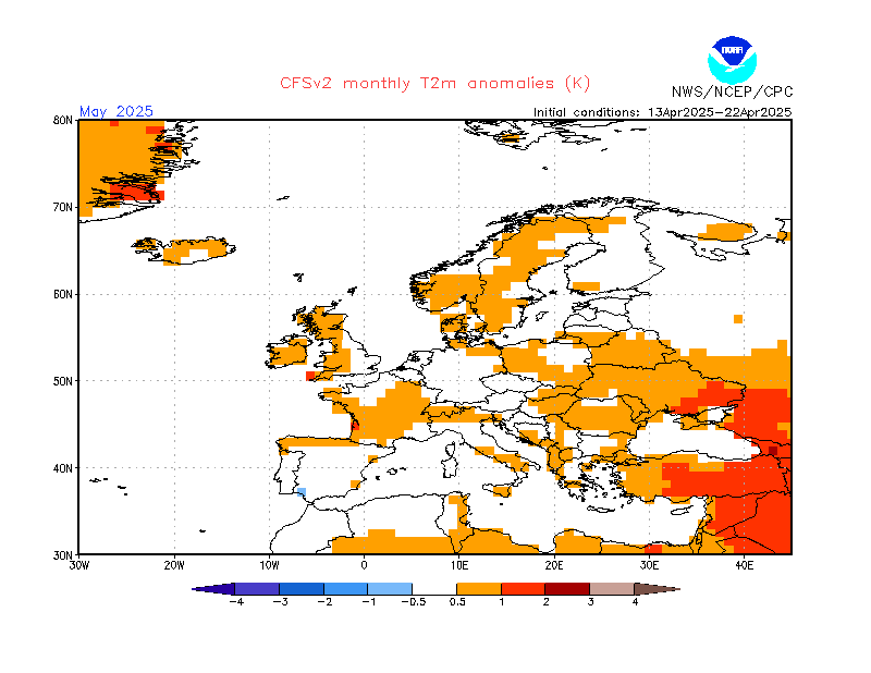
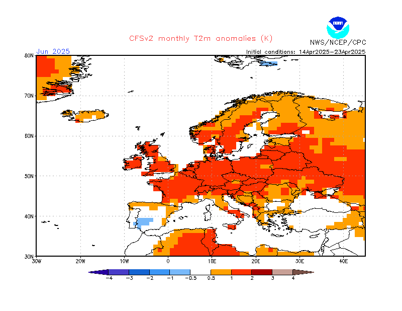
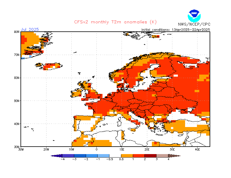
CFS Monthly 2M Temperature Anomaly Forecast