


UK 30 Day Forecast
Day 6 to 15
UK Outlook for Monday 29 Apr 2024 to Wednesday 8 May 2024: The weekend's rain probably clearing east and northeast to leave a drier day on Monday, although the chance of showers and even thunderstorms remains. Cloudier, wetter weather is likely to quickly arrive into the west, and slide east across southern areas early next week, such that the majority of the week will be characterised by wetter weather in southern UK, drier weather in northern, especially northwestern UK, and a chance of rain or even thundery showers for a time in the east. Temperatures likely to trend upwards, with the chance of a warm to very warm spell in some southern and eastern parts, before conditions probably turn drier, cooler and more settled from the west towards the end of the period.Day 16 to 30
UK Outlook for Thursday 9 May 2024 to Thursday 23 May 2024: In this period, the chances of unsettled weather are slightly less than usual in the north and about the same as usual further south. Therefore, some spells of wetter weather are likely for all, but perhaps especially southern areas with the driest conditions probably further north. Temperatures probably near average though with some cooler interludes possible. Also worth noting that average temperatures themselves rise by around 1C per week at this time of year.Forecast courtesy of Met Office Datapoint
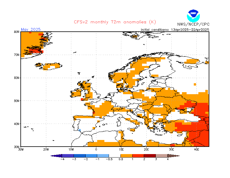
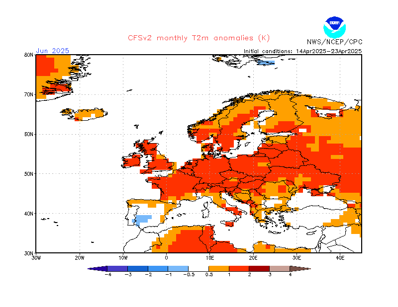
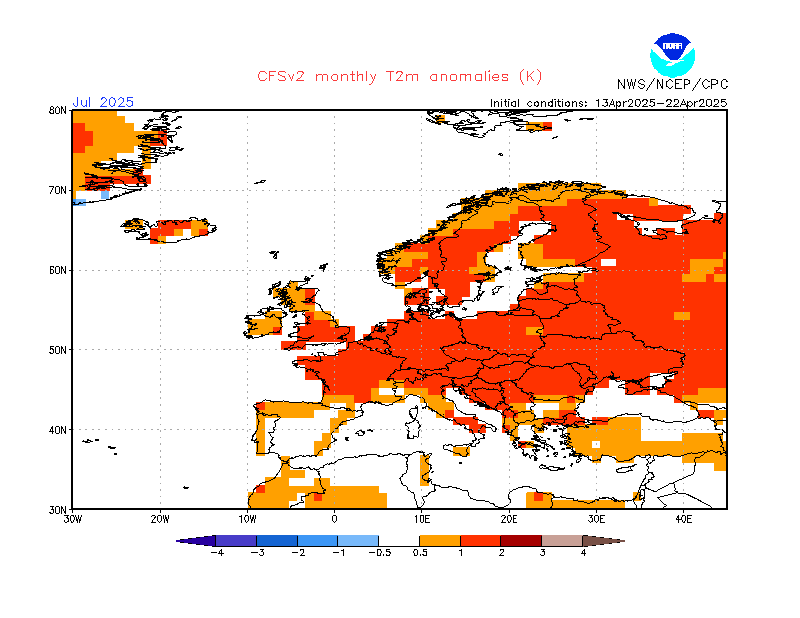
CFS Monthly 2M Temperature Anomaly Forecast